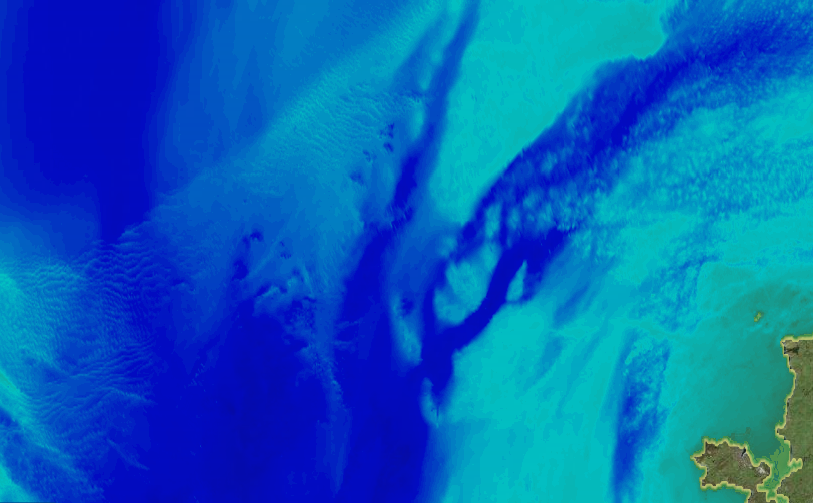
Marine Themes DEM Update

We have issued a major update to our flagship intelligent marine mapping dataset, Marine Themes Digital Elevation Model (DEM). The new dataset is being rolled out to all our Licensed Partners and public sector customers. Our private sector customers will receive the new dataset when they renew their annual licences. We have also improved our mapping web services which now include the updated dataset. This is being made available automatically when the service is accessed. Over 2,000 new surveys have been included in the update from a wide range of sources from across the public and private sectors.
We have upheld our mission to carefully quality control and select the most appropriate survey datasets for a particular area and to deconflict overlapping and adjacent surveys to avoid artefacts that result from inappropriate gridding methods. We have of course also updated the metadata or coverage layer that accompanies the DEM. This layer is essential in telling the user the source of data, including the age of each survey that has been included in the DEM, a key requirement when using the DEM for planning and in coastal and offshore engineering.
Marine Themes DEM is the most appropriate i.e. accurate, up to date and comprehensive source of seabed bathymetry data available. It is provided as a seamless surface model at a resolution of 1 arc second for immediate use in hydrodynamic and wave modelling, and in desktop and web GIS, as a base map and to undertake spatial queries. Example applications include marine energy site selection, pipeline and cable route planning, environmental impact and engineering studies.
In addition to our high resolution DEM, we continue to lead the UK’s input to EMODnet, working with partners across Europe and wider afield, and are delighted to support the GEBCO Seabed 2030 programme. The UK’s participation in EMODnet is as yet unaffected by Brexit, so we hope to remain involved for years to come. National, regional and ultimately global bathymetry is the ultimate core dataset underpinning almost all activities that take place at sea. Working with colleagues from national hydrographic offices and other agencies globally, we are proud to be doing our bit.
Did you know that elevation (or depth) in Marine Themes DEM is referenced to Chart Datum, which is approximately equal to the Lowest Astronomical Tide (LAT), but that we are able to transform the DEM so that it is referenced to Mean Sea Level (MSL) meaning that the DEM can be used directly in hydrodynamic modelling (where this is required) or combined with land elevation data in the coastal zone. Please contact us for details.


