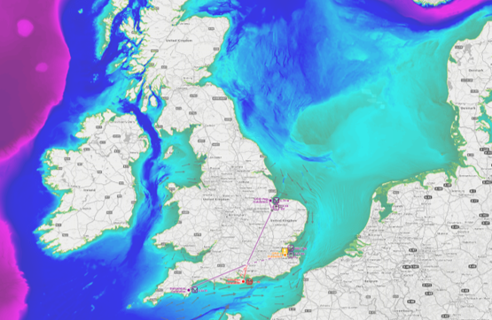
OceanWise Supports the Seabed 2030 project

Did you know that less than 20% of the world’s oceans have been surveyed to modern standards. Crazy really when we compare it to how much we know about the Moon and Mars!
The Nippon Foundation’s GEBCO Seabed 2030 Project aims to rectify this. Launched at the United Nations (UN) Ocean Conference in June 2017, it is aligned with the UN’s Sustainable Development Goal #14 to ‘conserve and sustainably use the oceans, seas and marine resources’. OceanWise’s MD, Dr Mike Osborne, was invited to be one of the team of experts that set up the initiative and is proud to be supporting the Seabed 2030 project as an associate, spreading the good word about what the project aims to do and why projects like this are so important and its potential impact.
What is the aim of the project?
To bring together all available bathymetric data to produce the definitive map of the world ocean floor by 2030, and make it available to all.
Why do we need this data?
Because bathymetry data matters! Knowing the depth and shape of the seafloor (bathymetry) is fundamental for understanding our oceans. Seabed mapping is “vital for the security, safety and economic health of nation states”. Not only does the Blue Economy provide millions of jobs it’s economic value is estimated at around $1.5 trillion dollars a year.
Better, comprehensive bathymetry will help us understand a wide range of important factors such as oceans circulation, tides, extreme weather patterns, fishing resources, sediment transport, environmental change, underwater geo-hazards, cable and pipeline routing, mineral extraction, oil and gas exploration and development, infrastructure construction and maintenance and much more. We are now also looking to the oceans as a renewable, sustainable energy source and predict a rise in the importance of both wave and tidal energy to support our global energy requirements in the future – which will require an in-depth understanding of the sea bed.
Why is OceanWise involved?
OceanWise personnel have been a pioneering force in developing marine mapping, tirelessly fighting to get better availability to marine data globally as input to our range of data products and services. Why? Because marine is equally important as land and the more data you have, the mightier the map, and better maps mean improved understanding and better planning, which means higher efficiency and insight.
OceanWise is the primary supplier of marine mapping data to the public and private sectors in the UK and increasingly globally where we have access to data. As passionate users and producers of mapping data, we also spread the word on data best practice, data management and appropriate use of marine data. We are very happy to be supporting the Seabed 2030 project and the important work that it is doing.
For more information on our range of mapping data please click here
For more information on the UN’s Sustainable Development Goals please see their website here
For more information on the Seabed 2030 including how you can get involved, please visit their site here


