Oceanwise Logo
LinkedIn Logo Twitter Logo
Log into Port-Log.net
Contact Page
+44 (0) 1420 768262
    • Home
    • About
      • About Us
      • News & Views
      • Events
      • Newsletters
      • Partners
      • Find a Partner
      • Professional Bodies
      • Our People
      • Careers
      • Contact Us
    • Sectors
      • Overview
      • Ports and Harbours
      • Maritime Pilotage
      • Offshore Renewables
      • Governments and Agencies
      • Customer Case Studies
      • Data as Infrastructure
    • Compliance
      • Compliance Overview
      • Marine Data Management
      • Asset Management System (AMS)
      • Aids to Navigation Management System
      • Conservancy Management
      • Spatial Data Management & GIS
      • Environmental Monitoring
      • Our Courses
    • Monitoring
      • Overview
      • Consultancy and Advice
      • Design and Integration
      • Installation and Maintenance
      • Data Telemetry
      • Data Collection, Management and Display
      • Air Quality for Ports
    • Training
      • Our Courses
      • Data Management
      • Data Management for Ports
      • Introduction to Change Management
      • Capacity Building
      • Technical Training
      • Product Training
      • Our Workshops
    • Mapping
      • Overview
      • Marine Themes Vector
      • Marine Themes DEM
      • ENC Web Map Service
      • Raster Charts
      • Raster Charts XL
      • Raster Charts XL Oceans
      • Mapping Data Buying Guide
      • Mapping Data FAQs
      • Data Originators
      • Vector Feature Catalogue
    • Partners
      • Overview
      • Become a Partner
      • Find a Partner
    • Support
      • Downloads
      • Portal
      • Support
      • Glossary of Terms
      • Contact Us
      • Terms and Conditions
banner
When you need to acquire, manage, use and share marine environmental data

When you need to acquire, manage, use and share marine environmental data

Enjoy the confidence of working with marine data experts

Learn More

When you need mapping data that is fit for purpose, in the right format, accurate and up to date

When you need mapping data that is fit for purpose, in the right format, accurate and up to date

Intelligent marine and coastal mapping data

Learn More

When you need to streamline your processes and workflows and support situational analysis

When you need to streamline your processes and workflows and support situational analysis

Enterprise GIS and productivity tools

Learn More

When you need to monitor and easily publish and share weather, tidal and other environmental data

When you need to monitor and easily publish and share weather, tidal and other environmental data

Environmental data sharing and publishing

Learn More

When you need to improve your data management skills, or advice on marine data management policy, strategy and systems

When you need to improve your data management skills, or advice on marine data management policy, strategy and systems

Capacity building, training and mentoring

Learn More

When you need to acquire, manage, use and share marine environmental data

When you need to acquire, manage, use and share marine environmental data

Enjoy the confidence of working with marine data experts

Learn More

When you need mapping data that is fit for purpose, in the right format, accurate and up to date

When you need mapping data that is fit for purpose, in the right format, accurate and up to date

Intelligent marine and coastal mapping data

Learn More

When you need to streamline your processes and workflows and support situational analysis

When you need to streamline your processes and workflows and support situational analysis

Enterprise GIS and productivity tools

Learn More

When you need to monitor and easily publish and share weather, tidal and other environmental data

When you need to monitor and easily publish and share weather, tidal and other environmental data

Environmental data sharing and publishing

Learn More

When you need to improve your data management skills, or advice on marine data management policy, strategy and systems

When you need to improve your data management skills, or advice on marine data management policy, strategy and systems

Capacity building, training and mentoring

London Marine Data Management and GIS Workshop 2015

OceanWise > OceanWise News & Views > Events > OceanWise Marine Data Management and GIS Workshops > London Marine Data Management and GIS Workshop 2015

Every year OceanWise host a free-to-attend Marine GIS Workshop in London to discuss relevant industry issues and how these can be solved using GIS. This year, over eighty people gathered to hear presentations on topical subjects including The foundations of Effective Data Management; The Importance of Latitude and Longitude coordinate reference systems, especially in web mapping applications, the latest on Real Time Data Sharing and Publishing technologies and Enterprise GIS. Case studies provided context of how OceanWise products and services are making a real difference in delivering more efficient conservancy and compliance. The opportunity to meet fellow professionals resulted in great networking, debate and discussions with extremely positive feedback. See below for presentation overview and downloads.

Introduction to maps.oceanwise.eu

Presented by Mike Osborne, OceanWise.
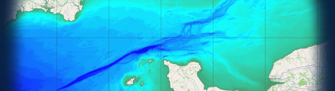
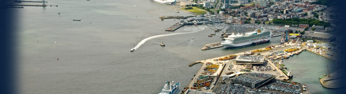
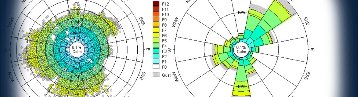
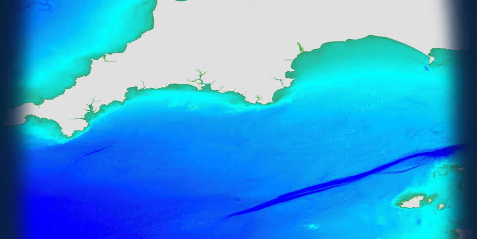
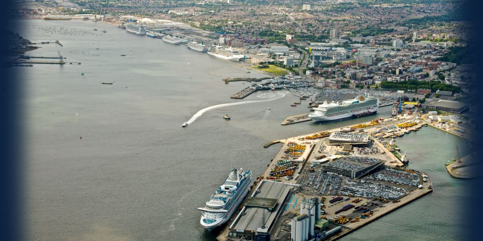
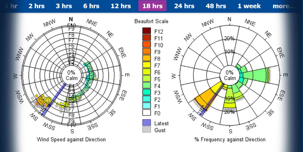
To start the workshop, Mike Osborne demonstrated OceanWise’s newly released online mapping system maps.oceanwise.eu which allows users to demonstrate OceanWise’s various data products in OGC compliant web mapping services. Web mapping services are rapidly becoming the fastest and most efficient way to consume marine data, with OceanWise at the forefront of this technology.
 
  Presentation

Taming the Waves: The Foundations of Effective Data Management

Presented by Nigel Turner, DAMA.
In the keynote address, Nigel Turner of the Data Management Association (DAMA), explained the importance of data governance and good data management and how bad data management could have a negative financial impact on your business. Using real-life examples Nigel was able to hit home the key messages that are critical to business success.
 
  Presentation

Creating a Common Operating Picture for Ports

Presented by George Spoelstra, Esri.
With a significant project with the largest Port in Europe, Port of Rotterdam, under his belt; George Spoelstra explained how ESRI has been able to implement an online system in which all of the port’s information could be accessed in just ‘three clicks’. In developing the solution, it was so important that the software and processes were made simply enough that the children of the project team as young as 6 years old were able to use it!
 
  Presentation

Real Time Data Sharing and Publishing

Presented by Martin Stemp, RS Aqua & Mark Jonas, OceanWise.
Using a combination of RS Aqua equipment and OceanWise’s Port-Log.net, Martin and Mark were able to demonstrate how real time oceanographic data could be displayed in an online system for analysts to interrogate and exploit.
 
  Presentation  Presentation

The Role of Web Mapping and other Geographical Outputs

Presented by Fergus Craig & Ian Usher, Cadcorp.
Ian & Fergus spoke about two of Cadcorp’s online applications, Web Map Layers & Notice Board. Web Map Layers is Cadcorp’s off-the-shelf web mapping product whilst Notice Board removes the map completely allowing people to view spatial information on a simple dashboard allowing quicker decision making.
 
  Presentation

Real Time GIS – Where else can you go with your tides?

Presented by Richard Farren, OceanWise.
Using only open-source applications and formats, Rich was able to demonstrate how online, real time wave, data could be loaded into a GIS to provide users with a simple, graphical feed of water depths. The example used displayed depth contours of a port channel, the colouring of which was automatically adjusted as the depths changed allowing ships to transit in the minimum of water using critical contours.
 
  Presentation

Maritime Toolbar (MTB) for SIS 8 and ArcGIS

Presented by Richard Marlow, OceanWise.
Leading the development of OceanWise’ enterprise-GIS products, Richard showcased our GIS extension ‘Maritime Toolbar’ which has recently been upgraded by providing new functionality to support Cadcorp SIS 8 as well as Esri ArcMap. ‘Maritime Toolbar’ makes common maritime and marine processes simpler by significantly improving the existing functionality in GIS.
 
  Presentation

Latitude & Longitude – Lies to Children

Presented by Mike Postle-Hacon, RPS Group.
Delivering a keynote presentation to remember with very important ‘take home’ messages; Mike pleaded with GIS users, especially those developing and using Web Mapping Services, to better understand and document the co-ordinate systems they are using. He explained, using some real-world examples, how using the wrong co-ordinate system can leave your presumed position many kilometres away from your intended target, cost of which is significant damage to profit and reputation of your business.
 
  Presentation

Using specialist GIS tools to deliver effective Port Conservancy

Presented by Maik Weidt, ABP Group.
Maik Weidt, of ABP Southampton, detailed the significant programme of work the port undertook to modernise its marine data management regime, resulting in replacing many legacy systems (e.g. access databases) into a powerful centralised accessible database. Over the course of two years OceanWise implemented its Ocean Database supplemented by its Enterprise GIS products (Maritime Toolbar & extensions) which has helped the port deliver significant time and resource efficiencies in daily tasks associated with conservancy and compliance.
 
  Presentation

How GIS enables the Sustainable Management of the UK’s Marine Assets

Presented by Pete Edmonds, The Crown Estate.
How does The Crown Estate determine how to best use the UK’s Exclusive Economic Zone? Pete Edmonds explained how GIS tools assists The Crown Estate to inform its business decisions and showed how good data and processes makes the management of its marine estate easier.
 
  Presentation

GIS and Marine Planning

Presented by James Lawson, Marine Management Organisation.
James Lawson outlined the MMO planning legislative framework and how maritime and marine data provides the important evidence on which planning decisions are based. He specifically looked at AIS shipping route and density data and how this and other data sources are now part of the Marine Information System (MIS) providing a visual context for stakeholders in the East Plan area.
 
  Presentation

Web Mapping for Offshore Decision Support

Presented by Sam Franklin, LR Senergy Group.
Sam spoke about the role of GIS beyond just the map! He outlined the Senergy data-stack and its role using open source tools and software to manage offshore projects such as surveys and cable laying plus the importance of access to real time metocean data to optimise operations.
 
  Presentation

Wales Marine Planning Portal

Presented by Bruce Jackson, Welsh Government.
Bruce Jackson showed the myriad of activities that are undertaken in the Marine environment in Welsh Territorial Waters, how the wealth of evidence contributes to developing the Marine Plan. This process is iterative as more evidence is gathered or comes to light. The building of the Planning Portal is based on open source technologies to reduce cost whilst increasing flexibility and it comprises over 290 data layers, with the marine mapping provided by OceanWise.
 
  Presentation

© OceanWise 2023. OceanWise Limited is an independent company specialising in marine environmental data acquisition, management, publishing and GIS.
Registrar of Companies of England and Wales No. 7206926 and Companies Registration Office Ireland No. 641571.

Terms & Conditions | Privacy Notice | Contact Us

OceanWise HelpBot

Still need help?